Agate Beach Tides: Tide Chart and Times
Marin County, California · Pacific time · feet
The tide at Agate Beach today starts with a high of 5.0 ft at 5:18 AM, falls to a low of 3.4 ft at 9:40 AM, climbs to a high of 6.1 ft at 3:27 PM, then falls to a low of −0.4 ft at 10:46 PM.
The falling tide is now 5.8 ft
Next high
13h 58m
5:23 AM
Next low
6h 21m
10:46 PM
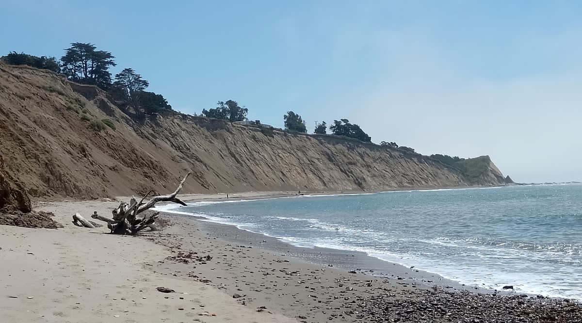
Agate Beach is a small county beach at the end of Elm Road in Bolinas and the main way down to Duxbury Reef. At high tide there is little dry sand, so the tide sets how much beach you get.
Saturday, October 31
Saturday, October 31
- ▲ ▲ High tide5:18 AM5.0 ft 5.0 ft
- ▼ ▼ Low tide9:40 AM3.4 ft 3.4 ft
- ▲ ▲ High tide3:27 PM6.1 ft 6.1 ft
- ▼ ▼ Low tide10:46 PM−0.4 ft −0.4 ft
Sunday, November 1
- ▲ ▲ High tide5:23 AM5.1 ft 5.1 ft
- ▼ ▼ Low tide10:14 AM3.3 ft 3.3 ft
- ▲ ▲ High tide3:42 PM5.7 ft 5.7 ft
- ▼ ▼ Low tide10:54 PM−0.1 ft −0.1 ft
Monday, November 2
- ▲ ▲ High tide6:18 AM5.3 ft 5.3 ft
- ▼ ▼ Low tide11:41 AM2.8 ft 2.8 ft
- ▲ ▲ High tide5:04 PM5.3 ft 5.3 ft
- ▼ ▼ Low tide11:56 PM0.1 ft 0.1 ft
Tuesday, November 3
- ▲ ▲ High tide7:04 AM5.6 ft 5.6 ft
- ▼ ▼ Low tide12:51 PM2.1 ft 2.1 ft
- ▲ ▲ High tide6:26 PM5.1 ft 5.1 ft
Wednesday, November 4
- ▼ ▼ Low tide12:50 AM0.5 ft 0.5 ft
- ▲ ▲ High tide7:43 AM5.9 ft 5.9 ft
- ▼ ▼ Low tide1:49 PM1.4 ft 1.4 ft
- ▲ ▲ High tide7:40 PM5.0 ft 5.0 ft
Thursday, November 5
- ▼ ▼ Low tide1:37 AM0.9 ft 0.9 ft
- ▲ ▲ High tide8:18 AM6.2 ft 6.2 ft
- ▼ ▼ Low tide2:38 PM0.7 ft 0.7 ft
- ▲ ▲ High tide8:46 PM5.0 ft 5.0 ft
Friday, November 6
- ▼ ▼ Low tide2:19 AM1.3 ft 1.3 ft
- ▲ ▲ High tide8:51 AM6.4 ft 6.4 ft
- ▼ ▼ Low tide3:22 PM0.2 ft 0.2 ft
- ▲ ▲ High tide9:46 PM5.0 ft 5.0 ft
Today and Tomorrow at Agate BeachThis Week at Agate Beach
Feet above MLLW · Pacific time · shaded = night
Tap the chart for the height at any time. The full week is in the table below.Hover or tap the chart for the height at any time.
Predicted vs Actual Water Level
NOAA Point Reyes gauge · last 2448 hours
Tide predictions cover only the pull of the moon and sun. NOAA's Point Reyes gauge, about 16 miles away, measures the real water level every 6 minutes, so the gap between the two lines is the weather: storm surge, wind, air pressure and runoff. The same gap usually holds across the Marin coast and Tomales Bay.
Loading live readings from NOAA…
Predicted Measured
Today at a Glance
Tidal range today
6.6 ft
Typical this month: 6.2 ft
Spring and neap cycle
Between springs and neaps
Next spring tide Nov 9, next neap Nov 3
How they work →Moon
Waning gibbous
60% lit, waning. New moon Nov 8
Sunrise and sunset
7:35 AM / 6:13 PM
10h 38m of daylight
Agate Beach Tide Table, Next 7 Days
From today · Pacific time
Today, Oct 31
- ▲ High 5:18 AM5.0 ft
- ▼ Low 9:40 AM3.4 ft
- ▲ High 3:27 PM6.1 ft
- ▼ Low 10:46 PM−0.4 ft
Sunday, Nov 1
- ▲ High 5:23 AM5.1 ft
- ▼ Low 10:14 AM3.3 ft
- ▲ High 3:42 PM5.7 ft
- ▼ Low 10:54 PM−0.1 ft
Monday, Nov 2
- ▲ High 6:18 AM5.3 ft
- ▼ Low 11:41 AM2.8 ft
- ▲ High 5:04 PM5.3 ft
- ▼ Low 11:56 PM0.1 ft
Tuesday, Nov 3
- ▲ High 7:04 AM5.6 ft
- ▼ Low 12:51 PM2.1 ft
- ▲ High 6:26 PM5.1 ft
Wednesday, Nov 4
- ▼ Low 12:50 AM0.5 ft
- ▲ High 7:43 AM5.9 ft
- ▼ Low 1:49 PM1.4 ft
- ▲ High 7:40 PM5.0 ft
Thursday, Nov 5
- ▼ Low 1:37 AM0.9 ft
- ▲ High 8:18 AM6.2 ft
- ▼ Low 2:38 PM0.7 ft
- ▲ High 8:46 PM5.0 ft
Friday, Nov 6
- ▼ Low 2:19 AM1.3 ft
- ▲ High 8:51 AM6.4 ft
- ▼ Low 3:22 PM0.2 ft
- ▲ High 9:46 PM5.0 ft
Minus Tides at Agate Beach
Daylight low tides below zero in the next 60 days, the best times for tidepooling and walking the low beach. More on what a minus tide is.
- Saturday, Nov 7, 4:01 PM−0.2 ft
- Sunday, Nov 8, 4:38 PM−0.5 ft
- Monday, Nov 9, 5:14 PM−0.5 ft
- Sunday, Nov 22, 3:25 PM−0.5 ft
- Monday, Nov 23, 4:08 PM−1.1 ft
- Tuesday, Nov 24, 4:53 PM−1.5 ft
- Saturday, Dec 5, 3:10 PM−0.2 ft
- Sunday, Dec 6, 3:49 PM−0.5 ft
Agate Beach Tide Chart: How Much Beach You Get
Read the Agate Beach tide chart before you drive out to Bolinas. The beach is small, at the end of Elm Road on the Bolinas mesa. At higher tides there is little if any dry sand. At low tide the sand widens and the flat shale of Duxbury Reef starts to show beyond it.
The parking lot is free and open sunrise to sunset, with restrooms and benches. It is about a five minute walk from the lot down to the tidepools. An accessible trail near the parking lot looks out over the beach and the reef, which is the best option on a high tide.
Tidepools and the Rules
Agate Beach sits inside the Duxbury Reef State Marine Conservation Area. Marin County Parks says you cannot take, damage or keep any species or materials from the beach, other than hook and line fishing. Despite the name, that includes the agates.
The good tidepooling only comes with a minus tide. On those days, limpets, chitons, mussels, barnacles, snails and anemones cover the exposed rock. Get down an hour before the low, and start back within an hour after the water begins to rise. Wear shoes that can get wet.
The tide comes back gently here compared with the open beaches farther up the coast, but sneaker waves still happen. Keep the ocean in front of you. There is no camping and no overnight parking.
Tides for Agate Beach are predicted from NOAA’s Point Bonita (Bonita Cove) station, about 11 miles southeast.
Tides Near Agate Beach
All Marin tides →How the tide is running right now at the closest spots.
Also close to Agate Beach: Alamere Falls 5.6 mi · Muir Beach 7.4 mi · Rodeo Beach 10 mi · Corte Madera Creek 11 mi · Richardson Bay 11 mi
Where the Agate Beach Tide Station Is
37.8183, -122.5283
Tide times for Agate Beach come from NOAA's Point Bonita, Bonita Cove tide station (9414906), about 11 miles away.
About Tides at Agate Beach
How the tide works at Agate Beach
Agate Beach gets mixed semidiurnal tides, the usual pattern on the California coast: two highs and two lows most days, with one high noticeably higher than the other and one low noticeably lower. The lower low is the one that uncovers the most shore.
A typical day here swings about 6.2 ft from low water to the next high. The biggest spring tides of the next month stretch that to about 9.0 ft, and the quietest neap days shrink it to about 3.4 ft. The next spring tides peak around Nov 9.
Where the Agate Beach predictions come from
Every time and height is a NOAA prediction for NOAA's Point Bonita, Bonita Cove tide station (9414906), about 11 miles away. It is a subordinate station: NOAA predicts its highs and lows by applying time and height offsets to the San Francisco (Golden Gate) reference station.
The curve between each high and low is drawn with the standard cosine method, so heights between the turns are close estimates. Weather can move the real water level: strong onshore wind and low air pressure raise it, and offshore wind and high pressure lower it. Read more on how tide predictions work.
Reading the tide clock, table and chart
The tide clock's hand sweeps from high tide at the top to low tide at the bottom and back, one full turn per tidal cycle of about 12 hours and 25 minutes. The countdowns on either side show the time to the next high and the next low.
The day picker and the 7-day table list each turn of the tide with its time and height. On the chart, each crest is a high and each trough a low; shaded bands are night. Heights are feet above mean lower low water, so a negative number is a minus tide. Our guide on how to read a tide chart goes further.
Agate Beach Tide Questions
Is there a beach at Agate Beach at high tide?
Barely. The National Park Service notes that at higher tides there is little if any dry sand at Agate Beach. Plan your visit around a falling or low tide if you want room to sit or walk, and bring shoes that can get wet.
When is the best low tide for Agate Beach tide pools?
Aim for a minus tide between about -0.5 and -1.5 feet, the range the California Department of Fish and Wildlife gives for the reef off Agate Beach. Arrive at least an hour before the low and leave within an hour after the tide starts coming back in.
Can you collect agates or rocks at Agate Beach?
No. Agate Beach is inside the Duxbury Reef State Marine Conservation Area, and Marin County Parks says you cannot possess, damage or take any species or materials on the beach. That includes rocks, shells and animals. Hook and line fishing is the main exception.
What time is high tide at Agate Beach today?
The panel at the top lists today's highs and lows at Agate Beach with their times and heights, and the tide clock counts down to the next high and the next low. Times are Pacific time and heights are in feet above mean lower low water (MLLW).
How big is the tide at Agate Beach?
Over the next 30 days the daily swing at Agate Beach runs from about 3.4 ft on the quietest neap days to 9.0 ft on the biggest spring tides, with 6.2 ft on a typical day. Like the rest of the California coast, most days bring two highs and two lows of unequal size.
Where do the Agate Beach tide times come from?
They are astronomical predictions from NOAA's Point Bonita, Bonita Cove tide station (9414906), about 11 miles away. Wind, storms, river runoff and air pressure can push the real water level higher or lower than predicted, so treat them as a planning guide, not a guarantee, and never use them for navigation.