Limantour Beach Tides: Tide Chart and Times
Marin County, California · Pacific time · feet
The tide at Limantour Beach today starts with a high of 4.4 ft at 4:56 AM, falls to a low of 3.5 ft at 9:03 AM, climbs to a high of 5.8 ft at 2:51 PM, then falls to a low of −0.5 ft at 10:37 PM.
The falling tide is now 5.2 ft
Next high
13h 30m
4:59 AM
Next low
6h 8m
10:37 PM
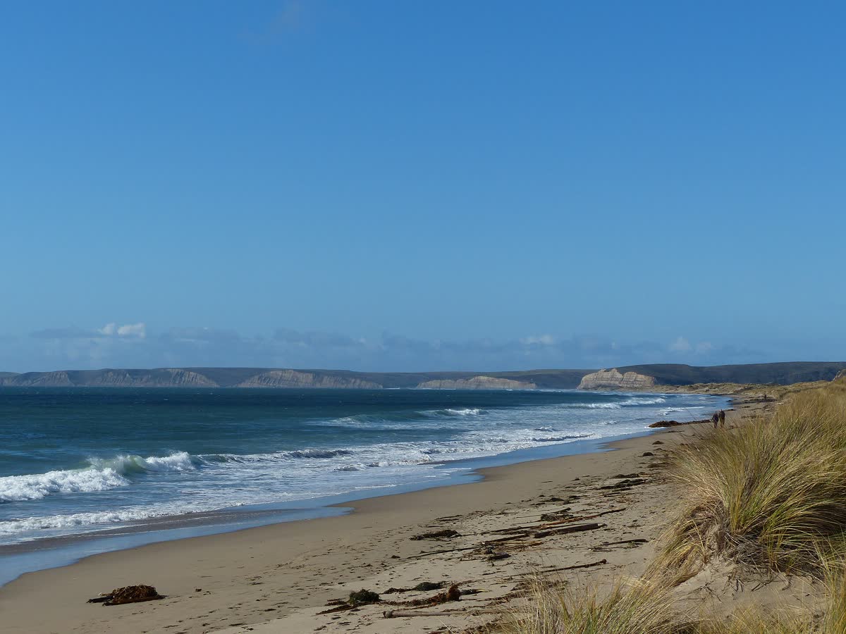
Limantour Beach is a long sand spit in Point Reyes National Seashore, with Drakes Bay on one side and Estero de Limantour on the other. The tide decides whether you can walk past it to Sculptured Beach and its tidepools.
Also covers Drakes Bay, Sculptured Beach, Santa Maria Beach.
Saturday, October 31
Saturday, October 31
- ▲ ▲ High tide4:56 AM4.4 ft 4.4 ft
- ▼ ▼ Low tide9:03 AM3.5 ft 3.5 ft
- ▲ ▲ High tide2:51 PM5.8 ft 5.8 ft
- ▼ ▼ Low tide10:37 PM−0.5 ft −0.5 ft
Sunday, November 1
- ▲ ▲ High tide4:59 AM4.6 ft 4.6 ft
- ▼ ▼ Low tide9:40 AM3.4 ft 3.4 ft
- ▲ ▲ High tide3:10 PM5.4 ft 5.4 ft
- ▼ ▼ Low tide10:41 PM−0.2 ft −0.2 ft
Monday, November 2
- ▲ ▲ High tide5:52 AM4.9 ft 4.9 ft
- ▼ ▼ Low tide11:12 AM3.0 ft 3.0 ft
- ▲ ▲ High tide4:35 PM5.0 ft 5.0 ft
- ▼ ▼ Low tide11:39 PM0.2 ft 0.2 ft
Tuesday, November 3
- ▲ ▲ High tide6:36 AM5.2 ft 5.2 ft
- ▼ ▼ Low tide12:28 PM2.3 ft 2.3 ft
- ▲ ▲ High tide5:58 PM4.8 ft 4.8 ft
Wednesday, November 4
- ▼ ▼ Low tide12:31 AM0.6 ft 0.6 ft
- ▲ ▲ High tide7:14 AM5.6 ft 5.6 ft
- ▼ ▼ Low tide1:30 PM1.6 ft 1.6 ft
- ▲ ▲ High tide7:15 PM4.7 ft 4.7 ft
Thursday, November 5
- ▼ ▼ Low tide1:18 AM1.0 ft 1.0 ft
- ▲ ▲ High tide7:48 AM5.9 ft 5.9 ft
- ▼ ▼ Low tide2:20 PM0.8 ft 0.8 ft
- ▲ ▲ High tide8:21 PM4.6 ft 4.6 ft
Friday, November 6
- ▼ ▼ Low tide1:59 AM1.5 ft 1.5 ft
- ▲ ▲ High tide8:19 AM6.1 ft 6.1 ft
- ▼ ▼ Low tide3:05 PM0.3 ft 0.3 ft
- ▲ ▲ High tide9:19 PM4.5 ft 4.5 ft
Today and Tomorrow at Limantour BeachThis Week at Limantour Beach
Feet above MLLW · Pacific time · shaded = night
Tap the chart for the height at any time. The full week is in the table below.Hover or tap the chart for the height at any time.
Predicted vs Actual Water Level
NOAA Point Reyes gauge · last 2448 hours
Tide predictions cover only the pull of the moon and sun. NOAA's Point Reyes gauge, about 5 miles away, measures the real water level every 6 minutes, so the gap between the two lines is the weather: storm surge, wind, air pressure and runoff. The same gap usually holds across the Marin coast and Tomales Bay.
Loading live readings from NOAA…
Predicted Measured
Today at a Glance
Tidal range today
6.3 ft
Typical this month: 5.9 ft
Spring and neap cycle
Between springs and neaps
Next spring tide Nov 9, next neap Nov 3
How they work →Moon
Waning gibbous
60% lit, waning. New moon Nov 8
Sunrise and sunset
7:36 AM / 6:13 PM
10h 38m of daylight
Limantour Beach Tide Table, Next 7 Days
From today · Pacific time
Today, Oct 31
- ▲ High 4:56 AM4.4 ft
- ▼ Low 9:03 AM3.5 ft
- ▲ High 2:51 PM5.8 ft
- ▼ Low 10:37 PM−0.5 ft
Sunday, Nov 1
- ▲ High 4:59 AM4.6 ft
- ▼ Low 9:40 AM3.4 ft
- ▲ High 3:10 PM5.4 ft
- ▼ Low 10:41 PM−0.2 ft
Monday, Nov 2
- ▲ High 5:52 AM4.9 ft
- ▼ Low 11:12 AM3.0 ft
- ▲ High 4:35 PM5.0 ft
- ▼ Low 11:39 PM0.2 ft
Tuesday, Nov 3
- ▲ High 6:36 AM5.2 ft
- ▼ Low 12:28 PM2.3 ft
- ▲ High 5:58 PM4.8 ft
Wednesday, Nov 4
- ▼ Low 12:31 AM0.6 ft
- ▲ High 7:14 AM5.6 ft
- ▼ Low 1:30 PM1.6 ft
- ▲ High 7:15 PM4.7 ft
Thursday, Nov 5
- ▼ Low 1:18 AM1.0 ft
- ▲ High 7:48 AM5.9 ft
- ▼ Low 2:20 PM0.8 ft
- ▲ High 8:21 PM4.6 ft
Friday, Nov 6
- ▼ Low 1:59 AM1.5 ft
- ▲ High 8:19 AM6.1 ft
- ▼ Low 3:05 PM0.3 ft
- ▲ High 9:19 PM4.5 ft
Minus Tides at Limantour Beach
Daylight low tides below zero in the next 60 days, the best times for tidepooling and walking the low beach. More on what a minus tide is.
- Saturday, Nov 7, 3:46 PM−0.2 ft
- Sunday, Nov 8, 4:25 PM−0.5 ft
- Monday, Nov 9, 5:03 PM−0.6 ft
- Sunday, Nov 22, 3:13 PM−0.5 ft
- Monday, Nov 23, 3:58 PM−1.2 ft
- Tuesday, Nov 24, 4:45 PM−1.6 ft
- Saturday, Dec 5, 2:55 PM−0.2 ft
- Sunday, Dec 6, 3:35 PM−0.5 ft
Limantour Beach Tides: The Low Tide Walk to Sculptured Beach
Limantour Beach tides decide how far you can walk. The beach is a narrow spit of sand between Drakes Bay and the estero. The trip people time with a tide chart goes the other way, southeast toward Sculptured Beach.
From the parking lot it is about 440 yards to the sand. Turn left and walk southeast. Past the end of Limantour you reach Santa Maria Beach, a mile of sand under sandstone bluffs with Coast Camp above it. Santa Maria Creek marks where the sand ends and the rocks of Sculptured Beach begin. There are no signs, so note where you came down.
Sculptured Beach at Low Tide
The National Park Service says Sculptured Beach should only be explored at a low or outgoing tide. At low water the carved rocks come out with the animals stuck to them. Visitors have been trapped here by the incoming tide. If the tide is coming in, do not go past the rocks.
Going farther to Secret Beach means passing a gap in the rocks called the Keyhole. That only works on a very low, negative tide, sometimes around -1 foot. The old Sculptured Beach Trail closed in 2023, so the beach walk is now the way in.
In winter, two creeks run across the sand to the ocean, and you will get your feet wet crossing them.
Seals and Closures
The western tip of Limantour Spit is a harbor seal pupping area. The park closes it to all entry each spring during pupping season. In 2021 that closure ran March 1 through June 30, so check the current dates with the park. Fishing is not allowed on the western end of Limantour Beach.
Tides for Limantour Beach are predicted from NOAA’s Point Reyes station, about 5.5 miles away at the end of the point.
Tides Near Limantour Beach
All Marin tides →How the tide is running right now at the closest spots.
Also close to Limantour Beach: Tomales Bay 8.2 mi · Agate Beach 13 mi · Bolinas 13 mi · Duxbury Reef 14 mi · Stinson Beach 16 mi
Where the Limantour Beach Tide Station Is
37.9942, -122.9736
Tide times for Limantour Beach come from NOAA's Point Reyes tide station (9415020), about 5.5 miles away.
About Tides at Limantour Beach
How the tide works at Limantour Beach
Limantour Beach gets mixed semidiurnal tides, the usual pattern on the California coast: two highs and two lows most days, with one high noticeably higher than the other and one low noticeably lower. The lower low is the one that uncovers the most shore.
A typical day here swings about 5.9 ft from low water to the next high. The biggest spring tides of the next month stretch that to about 9.0 ft, and the quietest neap days shrink it to about 3.4 ft. The next spring tides peak around Nov 9.
Where the Limantour Beach predictions come from
Every time and height is a NOAA prediction for NOAA's Point Reyes tide station (9415020), about 5.5 miles away. It is a reference station, with predictions calculated from harmonic constituents measured at that spot.
The curve between each high and low is drawn with the standard cosine method, so heights between the turns are close estimates. Weather can move the real water level: strong onshore wind and low air pressure raise it, and offshore wind and high pressure lower it. Read more on how tide predictions work.
Reading the tide clock, table and chart
The tide clock's hand sweeps from high tide at the top to low tide at the bottom and back, one full turn per tidal cycle of about 12 hours and 25 minutes. The countdowns on either side show the time to the next high and the next low.
The day picker and the 7-day table list each turn of the tide with its time and height. On the chart, each crest is a high and each trough a low; shaded bands are night. Heights are feet above mean lower low water, so a negative number is a minus tide. Our guide on how to read a tide chart goes further.
Limantour Beach Tide Questions
Can you walk from Limantour Beach to Sculptured Beach?
Yes, but only at low tide. Turn left at the beach and walk southeast about two miles along the water's edge, past Santa Maria Beach and Santa Maria Creek. Plan on about an hour each way. Visitors have been trapped at the rocky south end by the incoming tide, so leave before the water starts rising.
Are there tide pools at Limantour Beach?
Not on Limantour itself, which is sand. The tidepools are at Sculptured Beach, about two miles southeast, where the rocks show up at low tide. The National Park Service calls them the best and safest tidepools in the park. Go on a minus tide and arrive at least an hour before the low.
Are dogs allowed on Limantour Beach?
Yes, on a leash up to 6 feet, on the part of the beach southeast of the parking lot to Santa Maria Creek. Dogs are not allowed northwest of the lot, which is protected habitat for harbor seals and snowy plovers, and not on Sculptured Beach or Secret Beach.
What time is high tide at Limantour Beach today?
The panel at the top lists today's highs and lows at Limantour Beach with their times and heights, and the tide clock counts down to the next high and the next low. Times are Pacific time and heights are in feet above mean lower low water (MLLW).
How big is the tide at Limantour Beach?
Over the next 30 days the daily swing at Limantour Beach runs from about 3.4 ft on the quietest neap days to 9.0 ft on the biggest spring tides, with 5.9 ft on a typical day. Like the rest of the California coast, most days bring two highs and two lows of unequal size.
Where do the Limantour Beach tide times come from?
They are astronomical predictions from NOAA's Point Reyes tide station (9415020), about 5.5 miles away. Wind, storms, river runoff and air pressure can push the real water level higher or lower than predicted, so treat them as a planning guide, not a guarantee, and never use them for navigation.