Marin Live Webcams
Live cameras on Marin's flood spots, creeks, harbors and coast, for seeing what a king tide or a storm is doing right now.
Flood Cams on the Bay Shore
Cameras pointed at places that go under at a king tide or a storm surge.
Mill Valley · Club Evexia
Shoreline Highway and the 101 Ramp Live Cam →
Live video of Shoreline Highway and the freeway ramp by the Manzanita park and ride, the first place in Marin to go under at a king tide.
Sausalito · City of Sausalito and WebCOOS
Galilee Harbor Live Cam →
Put up by the city to track king tides, flooding and wave surge on Richardson Bay along the north Sausalito waterfront.
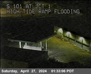
Highway 101 at Highway 1
Mill Valley · Caltrans
Right above the Manzanita park and ride and Shoreline Highway, the first spot in Marin to flood at a king tide.

Highway 37 at Atherton Avenue
Novato · Caltrans
Highway 37 runs along the bay at nearly sea level and closes when the marsh floods.
Creek Cams in Ross Valley
Town cameras on the creeks that flood San Anselmo, Fairfax and Ross in heavy rain. Worth watching when a storm lines up with a high tide.
San Anselmo · Town of San Anselmo
San Anselmo Creek at Bridge Street →
Downtown San Anselmo, where the creek has always overflowed first.
Fairfax · Fairfax Police
Fairfax Creek at Town Hall →
When the creek behind Town Hall reaches the deck, downtown Fairfax is about to flood.
Ross Valley · Ross Valley Fire
Ross Valley creek gauges and cameras →
All the Ross Valley creek cameras on one page, with the county flood gauges for San Anselmo, Sleepy Hollow, Fairfax and Ross.
Bay and Harbor Cams
Views over Richardson Bay and Belvedere Cove. Docks, seawalls and pilings show how high the water is.
Sausalito · Inn Above Tide
Inn Above Tide →
From the water at the ferry landing, across the bay to Alcatraz, Angel Island and San Francisco.
Sausalito · Open Water Rowing Center
Schoonmaker Dock →
The harbor and docks at Schoonmaker Point, good for seeing how high the water sits on the floats.
Tiburon · EarthCam
Belvedere Cove →
Live video over Belvedere Cove and the Tiburon waterfront.
Belvedere · Belvedere-Tiburon Landmarks Society
China Cabin →
From the China Cabin on Beach Road, right at the edge of Belvedere Cove.
Coast Cams
Muir Beach and Point Reyes, for surf, fog and big tides on the ocean side.
Muir Beach · sigward.com
Muir Beach →
A private cam looking over Muir Beach and the mouth of Redwood Creek.
Point Reyes · National Park Service
Point Reyes Lighthouse →
Looks north up Point Reyes Beach from the lighthouse. On many days it shows nothing but fog.
Point Reyes · The Marine Mammal Center
Historic Lifeboat Station →
Drakes Bay by Chimney Rock, where the center releases rescued seals and sea lions.
Mountain Views
Cameras up high that look out over the bay and the coast. They are best for watching weather move in.
Mill Valley · ABC7
Mount Tamalpais →
From Mount Tam over Richardson Bay, Sausalito, Belvedere and the city. Good for watching a storm come in.
Mill Valley · rntl.net
Mount Tam toward Tiburon →
Looks over Tiburon, Sausalito and the Golden Gate Bridge.
All of Marin · ALERTCalifornia
ALERTCalifornia ridge cameras →
Wildfire cameras on Mount Tam, Big Rock, Mount Barnabe and Mount Vision. They also show fog, rain bands and the bay.
Highway Cams
Caltrans traffic cameras along 101 and 580 near the water, south to north. Each one reloads every minute while this page is open.

Highway 101 at the Marin City exit
Sausalito
Looks along 101 past Richardson Bay and the Marin City off ramp.

Highway 101 at Spencer Avenue
Sausalito
Upper Sausalito, above the waterfront.
Highway 101 at Vista Point
Sausalito
The north end of the Golden Gate Bridge, handy for checking fog and wind at the Gate.

Highway 101 at Greenbrae
Greenbrae
Near Corte Madera Creek and the Larkspur Landing marsh.

Highway 101 at Central San Rafael
San Rafael
Downtown San Rafael, a few blocks from the San Rafael Canal.

Highway 101 at I-580
San Rafael
The 101 and 580 split by the canal and the Francisco Boulevard flats.

I-580 west of Francisco Boulevard
San Rafael
The low ground east of downtown San Rafael along the canal.
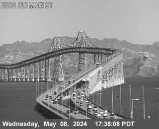
I-580 east of Main Street
San Quentin
The approach to the Richmond-San Rafael Bridge along the bay shore.

Highway 101 at Ignacio Boulevard
Novato
South Novato, near the Hamilton marshes.

Highway 101 at Highway 37
Novato
Where 37 leaves 101 and heads out across the Novato Creek marsh.
Marin County Flooding Today →
The next high tide, live gauge readings, creek levels and flood alerts for every part of Marin.
Marin Webcam Questions
Is there a live camera of the Manzanita flooding?
Yes. Club Evexia on Shoreline Highway runs a live cam pointed at the Highway 101 ramp and Shoreline Highway in Mill Valley, the stretch by the Manzanita park and ride that floods first when a king tide comes in. The Caltrans camera at Highway 101 and Highway 1 on this page shows the freeway just above it.
Is there a camera on the Ross Valley creeks?
Yes. San Anselmo runs a live camera on San Anselmo Creek at the Bridge Street bridge downtown, and Fairfax Police run one on Fairfax Creek behind Town Hall. Ross Valley Fire lists both on one page with the county creek gauges, which show the water level against flood stage.
How often do these webcam images update?
The Caltrans cameras post a new still image every few minutes, and this page loads the latest one every minute while it is open. The other cams are live video or update on their own sites. A camera can freeze or go dark for a while during storms or maintenance.
When is the best time to watch for flooding on the cams?
Watch the half hour before and after a high tide, on days with a king tide or a Coastal Flood Advisory. The flooding today page lists the next high tide for each part of Marin and how far above the tables the water is running.
Highway camera images from Caltrans District 4. Other cameras belong to the towns, businesses and groups named on each card. Any of them can be out of date or offline. For road closures check Caltrans QuickMap or 511.org.