Marin Headlands Tide Pools: Access, Parking and Low-Tide Timing
Marin Headlands tide pools are small pockets of rock and water at the ends of Rodeo Beach and in the coves below Conzelman Road, and they open up only at low tide. Park at Fort Cronkhite, walk to the rocks at either end of the beach, and pick a day when the predicted low drops to zero feet or below.

Set expectations first. This is not a wide reef like the ones farther up the coast, and our overview of the best tide pools in Marin explains where the big ones are. What the Headlands offers is rocky shoreline fifteen minutes from the Golden Gate Bridge, which is why people look for it.
Where the Marin Headlands Tide Pools Are
The Marin Headlands is the hilly point of land on the north side of the Golden Gate, inside Golden Gate National Recreation Area. Most of its shoreline is cliff. The places where you can reach rock and water are few, and they are worth knowing by name.
Rodeo Beach
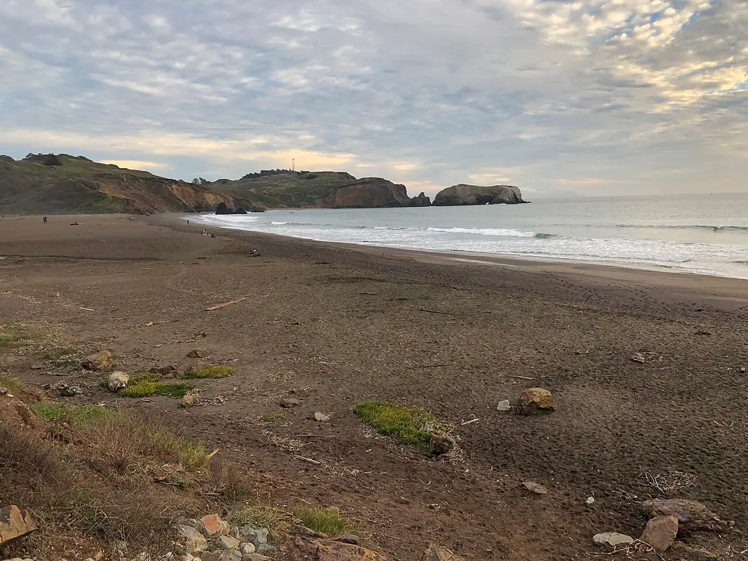
Rodeo Beach at Fort Cronkhite is the main spot. The beach itself is coarse pebble rather than sand, full of red and green chert worn down from the cliffs behind it. Low rock shelves and boulders at the north and south ends hold pools once the water drops. The south end, toward Bird Island, has the most rock.
Walk the beach to get there. Do not scramble around the headland on wet rock.
Black Sand Beach
Black Sand Beach sits below Conzelman Road between the bridge and Point Bonita. A steep switchback trail drops a few hundred feet to a dark, rocky cove with boulders at both ends. The trail has been closed for repairs in the past, so check park alerts before you count on it. Parking is a few pullouts on a one way road.
Kirby Cove
Kirby Cove lies directly under the north tower of the bridge. The road down is gated to cars except for campers with a reservation, so plan on about a mile of fire road each way, with that mile back uphill at the end. The pools here are in the boulders near the bluff.
Tennessee Cove
Tennessee Cove is the next valley north and the easiest walk of the four, roughly 1.7 miles each way on a wide, nearly flat trail from the Tennessee Valley trailhead. A rocky shelf on the north side of the cove shows at low tide. That lot fills early on weekends. If it is full, Muir Beach is a short drive north and has rock along both edges of its cove.
What Tide Height Do You Need?
Aim for a predicted low of 0.0 feet or lower. Tide heights on a NOAA chart are measured from mean lower low water, so a reading of minus one foot means the water sits a foot below that long term average. On a plus one or plus two foot low, most of the rock at Rodeo Beach stays covered.
Arrive an hour before the predicted low and leave within an hour after it turns.
Minus tides do not come every week. They cluster near new and full moons, the pattern covered in spring and neap tides. If the columns on a chart are new to you, how to read a tide chart goes through them.
Weather pushes the real water level away from the prediction. Onshore wind or a passing low pressure system can hold water higher than the chart says, which is the subject of tides and weather.
Driving In: The Tunnel, One Way Roads and Gates
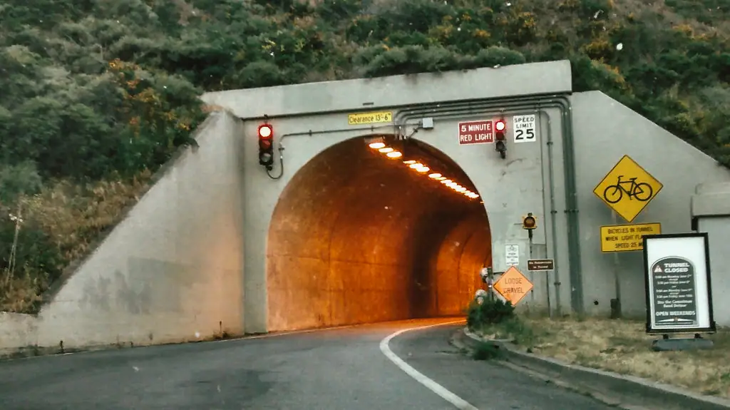
There are two ways in from the south. Bunker Road runs through the Baker-Barry Tunnel, a one lane tunnel with a signal that alternates direction, so expect a short wait at the light. Conzelman Road climbs from the bridge and turns one way westbound past the McCullough Road junction, which means once you commit you are going down past Point Bonita and around.
Point Bonita Lighthouse has its own gate and opens only on posted days and hours. The rocks below it are not reachable, so do not build a tidepool trip around it. The National Park Service page for the Marin Headlands lists current hours and closures.
Parking at Fort Cronkhite
The lot at the end of Bunker Road is the closest parking to Rodeo Beach, with no entrance fee and a flat two minute walk to the water. On a clear weekend it fills by mid morning, and the overflow lines the shoulder back toward Rodeo Lagoon.
A weekend afternoon minus tide in winter is the busiest combination you can pick. A weekday, or an early arrival for a morning low, fixes most of it.
Rules on the Rocks
This is a national park, so you leave what you find. No shells, no rocks, no animals, including the colorful pebbles people fill their pockets with at Rodeo Beach.
The rest is the usual code. Step on bare rock or sand instead of mussel beds and anemones, put back any rock you turn over exactly as it was lying, and never pull an animal loose from the stone.
Staying Safe at Rodeo Beach
Rodeo Beach has no lifeguards, cold water and a steep shore break with rip currents. Swimming is a poor idea even on a calm day.
Sneaker waves are the serious hazard on this coast. One wave runs far higher up the rock than the ones before it, knocks you over, and drags you back down the slope. The park service says tidepoolers have been killed this way on Marin beaches, and its tidepooling guidance is blunt about it. Keep your eyes on the water, stay off wet or weed covered rock, and wear shoes with grip.
Where to Go Next
Check the Rodeo Beach tide chart for the next low that drops near or below zero, then work backwards to figure out when to leave home. If no minus tide lands when you are free, or you want more rock than the Headlands can give you, the Duxbury Reef tide page covers the largest tidepool area in the county, up the coast at Bolinas.
Headlands Tide Pools Questions
Where are the tide pools in the Marin Headlands?
The main ones are at the north and south ends of Rodeo Beach, reached from the Fort Cronkhite parking lot at the end of Bunker Road. Smaller pools sit in the boulders at Black Sand Beach and Kirby Cove, both below Conzelman Road, and on the rocky shelf at Tennessee Cove. Most of the rest of the Headlands shoreline is cliff.
What tide height do you need for Marin Headlands tide pools?
Look for a predicted low of zero feet or lower, and a minus tide is better. Tide heights are measured from mean lower low water, so a minus one foot low puts the water a foot below that average. On a low of plus one or plus two feet, most of the rock at Rodeo Beach stays under water.
Where do you park for the Rodeo Beach tide pools?
Use the Fort Cronkhite lot at the west end of Bunker Road, past the one lane tunnel. It has no entrance fee and sits a flat two minute walk from the beach. On a sunny weekend it fills by mid morning, and cars then line the road shoulder back toward Rodeo Lagoon. Weekday mornings are much easier.
Are the Marin Headlands tide pools good for kids?
They work for short visits because the walk from the car is flat and brief. The pools are small, though, and the rocks at the beach ends are uneven and slick. Rodeo Beach has a steep shore break with no lifeguards, so keep children well back from the waterline and watch the ocean the whole time.
Can you take shells or pebbles from Rodeo Beach?
No. The Headlands is inside Golden Gate National Recreation Area, and national park rules prohibit removing natural objects. That covers the red and green chert and jasper pebbles that make Rodeo Beach popular with collectors, along with shells, rocks and anything alive. Photograph what you find and leave it where it is.