Marin Tides vs the WET App: Which Marin Tide App Is Easier to Use?
Marin Tides and the WET app (marinflood.com) both show Marin tides and flood risk, but they’re built for different jobs. Marin Tides tells you the next high and low tide in a plain sentence the moment the page loads, and its email alerts need no account and no app. The WET app is a feature-packed app aimed at people who want to track flooding at one exact spot, and it takes more setup to get there.
We built Marin Tides, so read this as our side of the comparison. Everything said about the WET app below comes from using it on a phone in November 2026 and from the text inside the app itself.
Marin Tides vs the WET App at a Glance
| Marin Tides | WET app | |
|---|---|---|
| First thing you see | Today’s highs and lows in a sentence, with times | A tide curve with fish, jellyfish and seaweed, plus a stack of pop-ups on a first visit |
| High and low times | Written out (for example, “high of 6.4 ft at 10:47 AM”) | Heights on the curve, times read off the hour axis |
| Pinch to zoom on phones | Works | Blocked in the page code (iPhones ignore the block) |
| Tide data | One of 13 NOAA prediction stations in Marin, usually the closest | San Francisco gauge at the Golden Gate, shifted for each spot |
| Alerts | Email, free, no account, no app | Push or email, free, account required, one Tide Alert location per account |
| What you have to set | Your email and a spot | A map flag, a name, and an alert height in feet above MLLW |
| Paid tier | None | Pro, $12 a year, for days 8 to 14 of the weather forecast |
Which One Is Easier to Read?
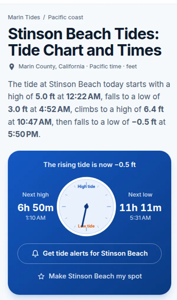
Marin Tides is easier to read, because it writes the answer down. Open the Stinson Beach tide page and the first sentence lists every high and low for the day with its time and height. Below that, a tide clock counts down to the next high and next low, and day cards repeat the times in large type.
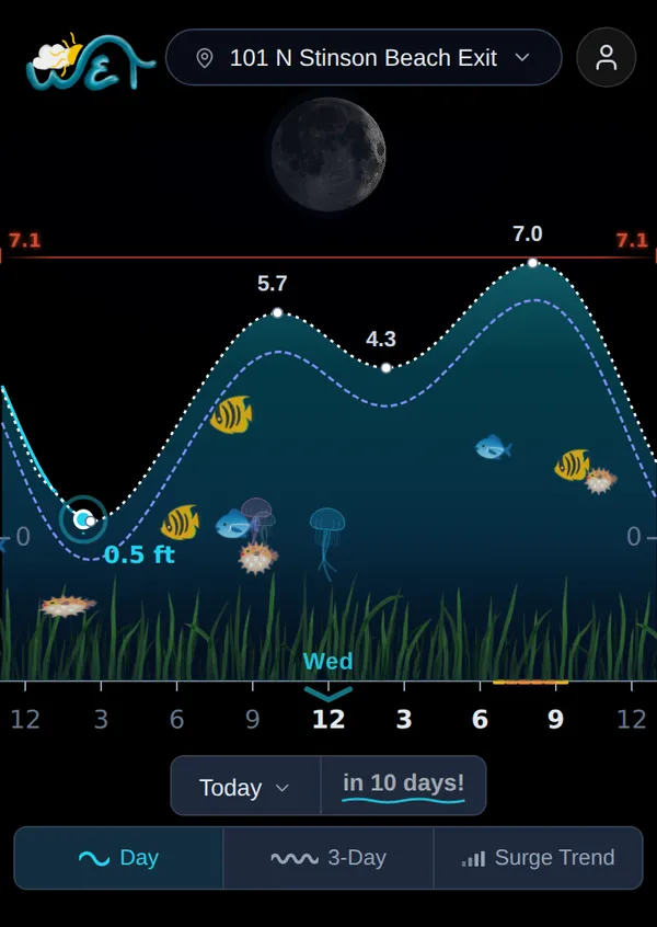
The WET app’s main screen is a tide curve drawn as an aquarium, with animated fish swimming in it. The heights sit on the peaks and dips. On the default Day view the times don’t appear as text, so you line up each peak with the hour marks along the bottom to work out when it happens. That’s fine for a quick look at the shape of the day, but harder if you need to know whether the high comes at 10:15 or 10:45.
Pinch to Zoom and Contrast
Marin Tides lets you pinch to zoom its pages, and it uses dark text on a light background. The WET app’s page code sets user-scalable=no, which blocks pinch zoom in some phone browsers, such as Chrome on Android. Safari on iPhone ignores that setting. Its design is light gray and colored text on a near-black background. Some people like a dark screen. If you rely on zoom to read small text on an Android phone, that setting gets in the way.
Which One Is Faster to Start Using?
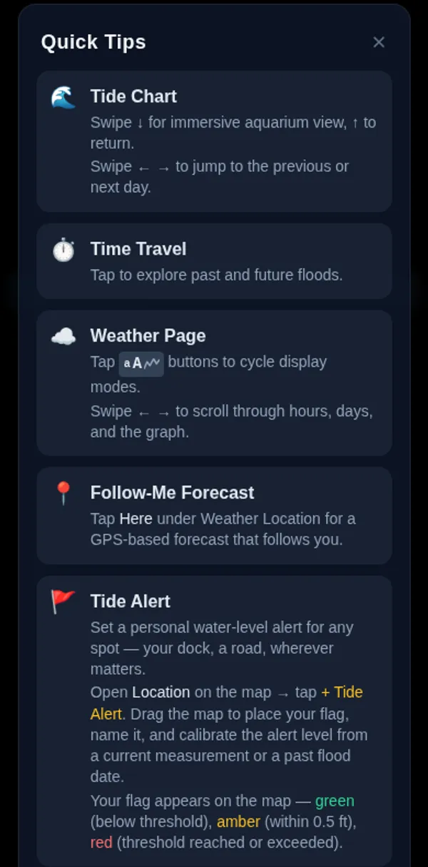
On a first visit, the WET app opens a “Quick Tips” panel with eight cards: Tide Chart (with its swipe gestures and aquarium view), Time Travel, Weather Page, Follow-Me Forecast, Tide Alert, Surge Trend, Events and Flood Digest. Close it and a “Where are you?” sheet asks for your location, and an “Install WET” prompt asks you to add the app to your home screen.
Marin Tides has no tour. Each of the 19 spots has its own page, from Dillon Beach and Tomales Bay down to Sausalito, and the home page map sorts them by distance if you tap “My location.” The alert sign-up box only opens once you’re more than halfway down a page or have spent 45 seconds on it, and it stays closed for two weeks once you dismiss it.
Which Has Better Free Alerts?
Both are free. Marin Tides is simpler to sign up for, and it sends four kinds of tide news instead of one water-level alarm. Marin Tides alerts need an email address and a spot, or “All of Marin.” Confirm the email and you’re done. You can choose any of these:
- Your tides for the week, every Sunday evening, with a note when a daylight minus tide or a king tide falls in it.
- A flood warning each morning while the National Weather Service has a Coastal Flood Advisory, Watch or Warning out for Marin, with that day’s highs at your spots.
- A heads-up two days before each of the season’s highest tides.
- A tidepool note the evening before a daylight minus tide.
The WET app’s alerts work differently. You sign up for an account first, with email and password, Google or Apple. Then you drop a flag on the map, name it, and set an alert height, either from a measurement you take or from a past flood date it looks up on the San Francisco gauge. The app’s own help text says each account can have one Tide Alert location for now.
That design is good for one job: warning you when water reaches your dock or your driveway. For most people who just want to know when the big tides and flood advisories are coming, it’s a lot of setup for one spot.
Where Does the Tide Data Come From?
Marin Tides uses the predictions NOAA Tides and Currents publishes for its tide stations in Marin. Each spot is matched to one of 13 stations, usually the closest, including Point Reyes, Bolinas Lagoon, Inverness, Marshall, Sausalito, Point San Pedro, Corte Madera Creek and the Petaluma River entrance. The data refreshes every night. Our page on how tide predictions work explains what goes into them.
The WET app’s own text says it starts from the San Francisco reference station at the Golden Gate (NOAA 9414290) and adjusts it for each local point. It also runs its own “Unified Forecast,” which blends in live gauge readings, air pressure and wind to forecast the water level you’ll actually get.
Marin Tides covers that real-world gap too. Every spot page compares the prediction with the nearest NOAA live water-level gauge, and the Marin flooding today page pulls together active Weather Service flood alerts, the next high at each part of the shoreline and the creek gauges in one place.
What Does the WET App Do That Marin Tides Doesn’t?
The WET app has features we don’t. It collects flood photos and reports from people around Marin, and it shows a surge trend for five NOAA stations from San Diego to San Francisco. It also has a full weather page, a personal water-level alert you calibrate yourself, and an events planner with RSVPs. That’s a lot for one app, and part of why it takes longer to learn.
If you live on a houseboat or a low street and want an alarm set to the inch for one spot, the WET app’s calibrated alert is built for that.
Which Should You Use?
Use Marin Tides if you want tide times written out in plain words, a page for the beach or harbor you actually go to, and free alerts that need only an email. Check the king tides guide before the winter tides, and use the flood simulator to see which streets go under at a given water level.
Use the WET app if you’d rather have an app on your home screen and a custom flood alarm for one exact spot, and you don’t mind setting up an account to get it.
Marin Tides vs WET App Questions
What is the WET app?
The WET app (short for Weather Events Tide) is a Marin flood and tide app that runs in the browser at marinflood.com, with an iPhone app on the App Store. It combines a tide chart, weather, flood reports from users, personal water-level alerts and an events planner.
Is Marin Tides free?
Yes. Every tide page, the flood map, the flooding page and the email alerts are free. There is no paid tier, no account and no app to install.
Are the WET app's alerts free?
The WET app doesn't charge for its tide alerts, but you need an account to set one, and each account gets one Tide Alert location. Its paid Pro tier, $12 a year, adds the second week of its weather forecast.
Do I need an account to get Marin Tides alerts?
No. Enter your email, pick a spot or all of Marin, and click the link in the confirmation email. Every alert email has a one-click unsubscribe link.
Where do Marin Tides predictions come from?
From NOAA's tide prediction stations in Marin. Each of the 19 spots uses one of 13 NOAA stations, usually the closest, from Point Reyes and Bolinas Lagoon to Inverness, Sausalito and the Petaluma River entrance, and the data refreshes every night.